Application and advantages of LiDAR measurements
LiDAR Measurements
GEO-NET has been using remote sensing devices such as LiDAR (Light Detection And Ranging) measurements to determine wind conditions / wind potential / wind profile for more than 10 years. In the last years we have developed into one of the leading LiDAR experts in Germany and other European countries. In the meantime, we have installed more than 150 LiDAR systems according to the valid rules of TR6, IEC61400-50-2 and MEASNET and verified them at our own 200m reference mast.

From turnkey measurement campaigns to customised individual services
GEO-NET services:
- Verification of LiDAR systems at our own 200 m verification mast: we verify the LiDAR measurements required by the IEC guideline and Technical Guideline 6 (TR6) and determine the measurement uncertainty using calibrated cup anemometers at eight measurement heights up to 200 m above ground.
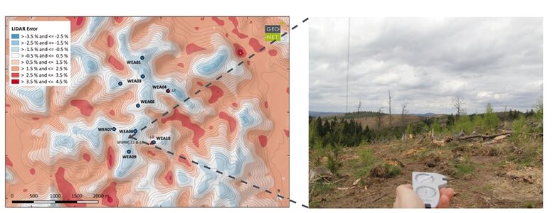
- Planning of LiDAR measurements: Measurement strategy and determination or optimisation of a representative measurement site to reduce uncertainty, including T-RIX complexity, site visit
- IEC-compliant installation and deinstallation of LiDAR systems (Leosphere Windcube v2, ZX) including self-sufficient power supply
- It is possible to check the installation and acceptance of LiDAR devices installed by third parties in accordance with the guidelines
- Support for the measurement campaigns: Data control and quality inspection, regular maintenance work (e.g. methanol and wiper water refill), monthly quality inspection, etc.
- Measurement report with assessment of the measurements for further bankable wind and energy yield reports (TR6, MEASNET)

Measuring principle and the practical installation of a LiDAR measurement
Measuring method

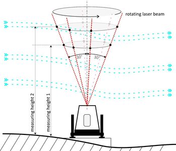
The measuring method of LiDAR (Light Detection And Ranging) is based on the reflection of aerosol particles that are transported by the wind. This allows the devices to detect the wind speed by analysing the reflected laser beams.
The measurement is non-contact and, unlike cup anemometers, is not affected by the inertia of the rotating cups. The sensitivity to turbulence is therefore different compared to cup anemometers.
In contrast to mast measurements, the measurement is not taken at one point in space, but is made up of several different point measurements on one plane. Due to the opening angle of the laser beam to the vertical, the measurement points are further apart the greater the measurement height.
Practical Installation of a LiDAR
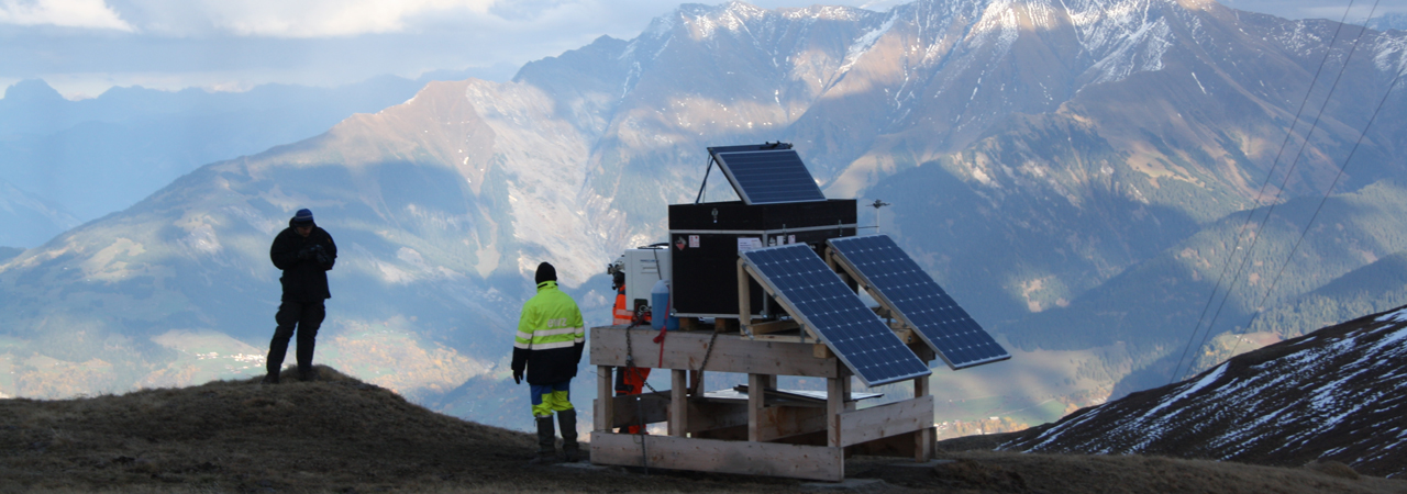
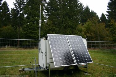
For practical implementation, the LiDAR and the external power supply are transported in a trailer to the pre-defined measurement location, or by jeep if the terrain is difficult. The installation is positioned in such a way that no reflections from obstacles such as trees, existing wind turbines or wind measurement masts can occur within the measurement volume. At most sites that do not have their own power supply, a self-sufficient power supply is installed using fuel cells and photovoltaic modules (hybrid power supply). Finally, the entire measurement site is secured by a fence, optionally also by camera surveillance.
LiDAR devices can be installed as the only measuring device in Germany and some other countries. A measurement campaign should last at least 12 months for a measurement that complies with the guidelines. A short-term measurement over six months can only be carried out if a comparison with corresponding comparative data is available.
In some scenarios, for example in complex terrain, it is not always possible to measure completely without a met mast.
In any case, a LiDAR measurement in the planned wind farm area represents an improvement in the database, so that a reduction in the uncertainty of yield forecasts and thus a higher P75 and P90 can be achieved.
Advantages of LiDAR measurements
- Compact size and short installation time
- Easy to transport and more flexible to use
- No building permit required
- Measuring heights of up to 200m and higher
Haben Sie Fragen?
Feel free to contact us or give us a call directly!
Tel: +49 (0)511 3887200
We are pleased to help you!
