City and regional climate analysis
We offer you a comprehensive analysis of the climate in your city or region and provide information on possibilities for optimizing the climatic situation on site today and in the future.
City and regional climate analysis
Climatic aspects are an increasingly important component for planning and development. Particularly in times of climate change, the topic of the urban heat island moves into the public focus during summer heat waves. Under these meteorological conditions, nocturnal cold and / or fresh air flows from the surrounding area and inner city green areas can contribute to the reduction of the thermal load. We offer city and regional climate analyzes, which show you the climatic connections in your city or region, and at the same time we provide proposals for action and planning to maintain and improve the climate.
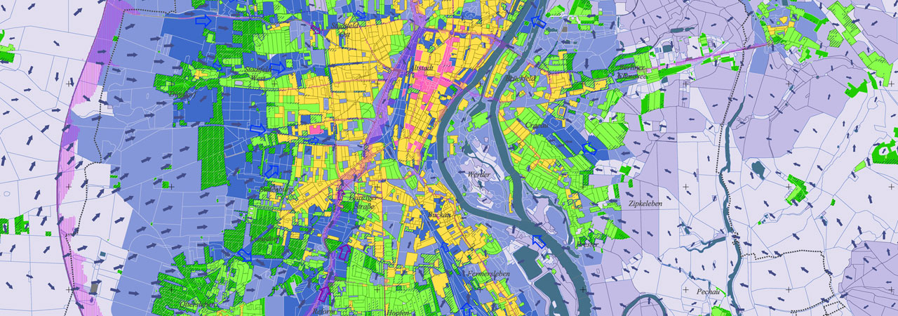
Our analyzes are carried out in several stages. First we are working on a climate map. With help of your provided data and the latest aerial photographs, we will review and evaluate the structures in your city or region. The classification of the areas is based on the building density, the degree of sealing, the location of the respective area as well as the type of use. The resulting map shows the various climatopes from the inner city climate to the open air climate.
In order to be able to comprehensively assess the climatic situation in your city or region, it is also useful to include the flow and process events of the nightly cold air supply.
We use the numerical simulation model FITNAH to display a wide range of climatic parameters (e.g. temperature, wind field, etc.). The results are combined in a map of the climate-ecological functions. This climate analysis map subdivides an urban area into differently warming settlements, cold-air-producing balancing areas (e.g. parks, agricultural areas) as well as constructions that allow air to be exchanged between balancing and effluent areas.
In a further step, the sensitivity of the climatic functions against structural changes is assessed and presented in a planning map city climate. It provides concrete information on which green areas are particularly important for the ventilation of the city center and which residential areas are exposed to climatic conditions. It also provides proposals for the implementation of spatial climatic quality objectives.
Environmental meteorology
- City and regional climate analysis
- Climate ecologic assessments
- Air hygiene assessments
- Concepts and assessments on climate protection
- Strategies and assessments on climate change adaption
